
Shadow analysis is attractive because it appears mathematical: measure a line, enter a time and obtain a direction. The calculation may be precise while its inputs are wrong. Before using a shadow to narrow location, verify that the object is vertical, the receiving surface is understood, the image is not mirrored and the capture time has a reliable timezone.
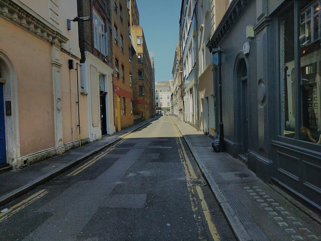
Case study: metadata that should not be trusted blindly
The public record identifies Gilbert Place in London and gives 9 April 2017 at 20:17:05 UTC. The photograph, however, shows a blue sky, a brightly illuminated street section and hard-edged building shadows. In London on 9 April, 20:17 UTC is after sunset. The visual conditions are incompatible with treating that timestamp as the actual capture time in UTC.
This does not prove the location is wrong. It shows that at least one time assumption is unreliable: the camera clock may have used another timezone, the platform may have transformed the timestamp, or the published field may describe file handling. A responsible investigation stops the solar-time calculation here instead of adjusting parameters until London fits.
The shadow-readiness test
| Requirement | Why it matters | Case result |
|---|---|---|
| Reliable date | Solar declination changes by season | Date plausible but not independently proven |
| Reliable local time | Sun azimuth changes quickly | Fails visual consistency |
| Known orientation | Image top is not north | Could be recovered from mapped street |
| Vertical object and visible shadow | Needed for measurable geometry | Building shadows exist, but source edges are complex |
| Known surface slope | Slope alters apparent angle | Street appears near level, not surveyed |
A safe solar workflow
- Preserve the original and record timestamp source and timezone.
- Choose a vertical object with visible base and complete shadow tip.
- Correct for image rotation or mirroring.
- Estimate camera orientation from mapped road geometry.
- Measure a range, not a single pixel-perfect angle.
- Test several plausible times and locations with a solar-position tool.
- Use incompatible shadows to reject candidates; do not use one approximate match as proof.
How terrain adds independent evidence
For rural images, mark the complete horizon sequence: peaks, saddles, ridgelines, coastline direction and relative apparent heights. Compare the sequence from a candidate viewpoint using a terrain model. One triangular peak is common; a five-feature skyline in the correct order is much stronger.
Account for focal length, cropping and elevation. A terrain match should also explain foreground geometry such as the valley direction, road bend or shoreline. If the skyline matches only after moving the viewpoint kilometres away from the road visible in the image, reject it.
Main failure modes
- Upload or screenshot time mistaken for capture time.
- UTC treated as local time or daylight saving ignored.
- Sloped ground treated as horizontal.
- A façade shadow mistaken for the direct solar direction.
- Mirrored image reversing east and west.
- Lens distortion or crop changing apparent geometry.
- Cloud shadows mistaken for object shadows.
The correct conclusion for the London case is not a calculated longitude from the shadows. It is that the published time is unsuitable for solar geolocation, while the fixed street geometry and independent published coordinates can still verify the place. Knowing when not to calculate is part of the method.
Sources
Put the method into practice
When you have a photo to investigate, start with our AI photo location finder and treat its result as a lead to verify, not automatic proof.